The Cimarron Meridian and Base Line (Panhandle)
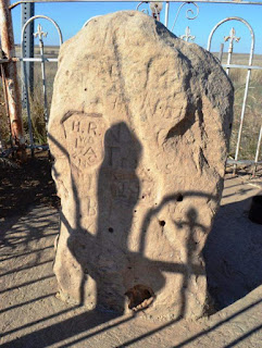
In an earlier blog I discussed the Initial Point , which is the origin for the majority of surveys in the State of Oklahoma. The exception being the Panhandle, which has its own history and point of origin for the surveys that followed after it became part of Oklahoma Territory. “The public land strip which is included in said territory of Oklahoma, is bounded by the one hundredth meridian, south by Texas, west by New Mexico, north by Colorado and Kansas” excerpt from the Organic Act of 1890 Eventually, there would be a need to lay out the lands into sections and quarter sections just as the “main body” of Oklahoma was done. The “other” Initial Point was too far away to serve as a sufficient starting point for the surveys, so a new starting point was established just for this small strip of Oklahoma. The starting point (Cimarron Meridian and Base Line) was determined to be located at the intersection of 103 degrees of west longitude (meridian) and 36 degrees and 30 ...